
Murwillumbah to crabbes creek MAPS
Explore the towns and villages that connect the Northern Rivers Rail Trail between Murwillumbah and Crabbes Creek.
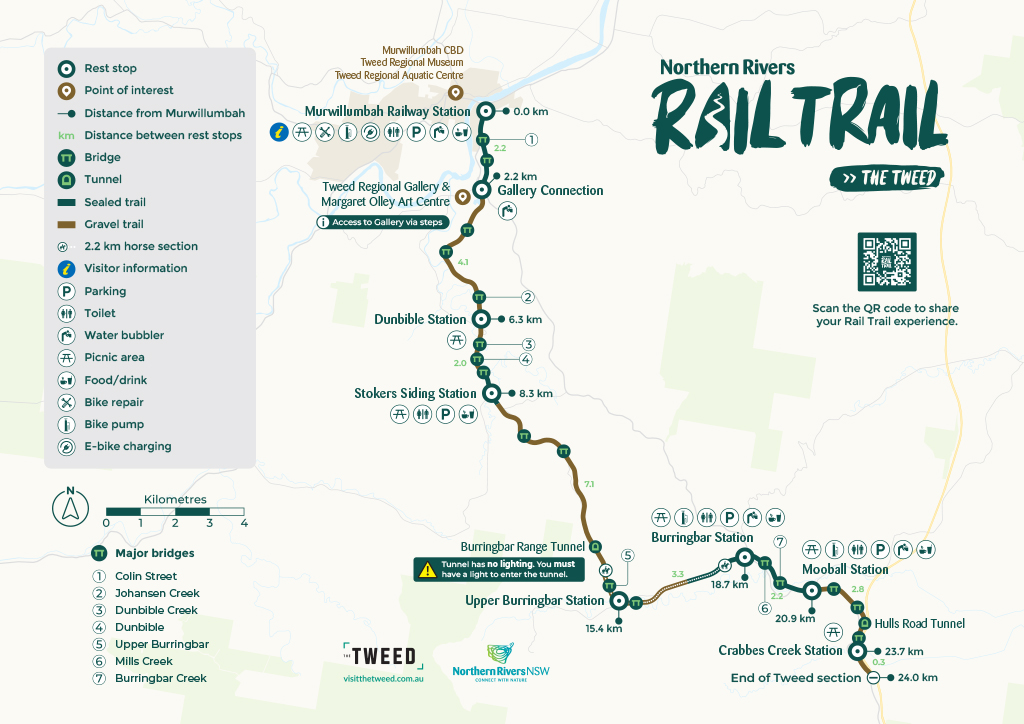
This 24 km section starts at the state heritage listed Murwillumbah Railway Station. It connects to the Tweed Regional Gallery & Margaret Olley Art Centre and continues through to the villages of Stokers Siding, Burringbar and Mooball before concluding at Crabbes Creek.
Download a printable map of the Murwillumbah to Crabbes Creek section (24 km)
Download an elevation map of the Murwillumbah to Crabbes Creek section (24 km)

You can also download a GPX file of the Northern Rivers Rail Trail to load into your own GPS software, apps or systems. Three different files are available depending on your chosen route.
- Tweed section: North to South (Murwillumbah to Crabbes Creek)
- Tweed section: South to North (Crabbes Creek to Murwillumbah)
- Tweed section North to South to North (Murwillumbah to Crabbes Creek to Murwillumbah)
Looking for other maps – check out the Casino to Lismore section maps.