
Maps of the Northern Rivers Rail Trail – Richmond Valley section
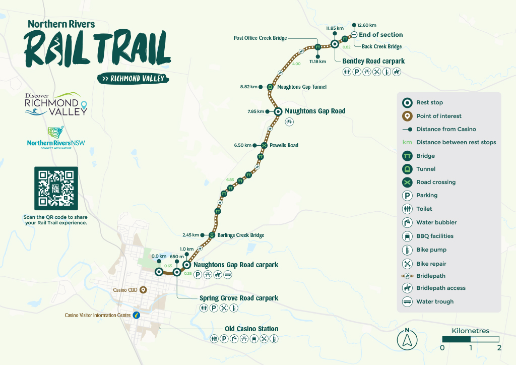
The 13.4 km Casino to Bentley section starts at the heritage-listed Old Casino Station and connects with the Spring Grove Road and Naughtons Gap car parks. It moves through rich agricultural lands, passes over a tunnel housing a mixed colony of Bent-winged bats, to finish at the historic Bentley Bridge.
Download a printable map of the Richmond Valley section map (13.4 km)
Download an elevation map of the Richmond Valley (13.4 km) section here.

Looking for other maps – check out the Tweed section map.